


Guest Essay: Fracking and earthquakes: Let’s look at the data
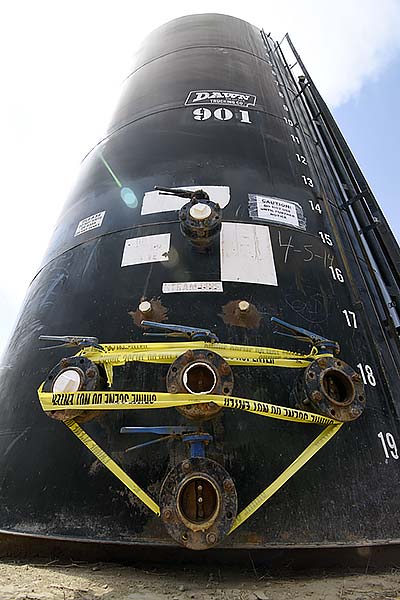
Yellow caution tape instructs emergency personnel to not touch them Thursday in Shiprock, N.M. Two large tanks were brought in by the U.S. EPA in an effort to increase production in providing water to stricken farmers and ranchers who've been left without a means to water their livestock and crops. It was later discovered the tanks were fracking tanks, which hold dangerous mining chemicals. (Times photo - Donovan Quintero)
By Michael Daly
There has been a good deal of concern regarding the effects of hydraulic fracturing (“fracking”) and disposal of drilling fluids in injection wells. With this in mind we did some research to see what effects are being reported in the Four Corners area of New Mexico and Arizona and more broadly to see what other researchers are reporting.
The fracking process
Fracking has been used in oil and gas wells for many decades. It involves injecting chemical-laden water at high pressure into geologic formations to extract oil and gas. The pressure injects water containing chemicals and sand. When the pressure is removed the sand particles remain in the small fractures keeping them open and allowing the flow of oil and/or gas.
A recent development is the technique of horizontal drilling. There are many thin layers of petroleum-bearing rock formations that are economically available for drilling due to the ability to drill the well horizontally.
This true revolution has made it possible for the U.S. to be the only country in the world to reduce carbon dioxide emissions by seven percent by converting coal-powered plants to natural gas. It has also made us energy-independent and has substantially lowered the cost of gas worldwide. However the process is not without some negative consequences.
The process is distributed over a large area and only very seldom causes small earthquakes. “Small” is in the sense that we don’t feel them or hardly feel them at the ground surface. This is because the fracking pressure is distributed over a long distance.
But the process sometimes uses millions of gallons of water which must be disposed of later. This water, and water pumped as part of other oil and gas well operations, is usually pumped deep underground into injection wells.
Injection well operations
The water is basically from two sources. First many existing oil and gas wells produce water in addition to the desired oil and gas. In the past, this water was usually placed in evaporation ponds for disposal. Today, much of this oily water is collected and taken to an injection well for disposal.
State agencies, when approving these injection wells, require that the wastewater is pumped into a formation deep underground, way below formations that contain good-quality water, to prevent contamination, and in locations far from population centers.
In some areas there are few problems associated with this process, as in northwest New Mexico. In other areas, notably in Oklahoma, geologic activity and conditions are such that the injected fluids cause man-made earthquakes.
Man-made earthquakes
Man-made earthquakes of this type are triggered when a large amount of wastewater is injected in one place, which is exactly what injection wells do. In Oklahoma’s case, they have an enormous number of wells –some 4,600 –and geologic conditions that can encourage earthquakes.
The largest earthquake ever recorded in Oklahoma had a magnitude of 5.6 and is believed to have been caused by an injection well. (Information: Google “Artificial Quakes Shake Oklahoma, Witze”)
The state of Oklahoma has now established a 10-kilometer (three-mile) buffer zone around injection wells.
The hydraulic fracturing process itself, by contrast, is rarely associated with an earthquake and never has been tied to an earthquake greater than magnitude 4.
In a recent study, geologists from Durham University in the United Kingdom compiled what is considered the most complete database to date of man-made earthquakes. The scientists spent a year looking through records stretching back to the 19th Century.
Their database lists 715 earthquake sequences, each consisting of as many as several hundred earthquakes. Their conclusion was that man-made earthquakes are grossly under-reported. This report was presented at the American Geophysical Meeting in San Francisco in December 2016 and recently reviewed in the journal EOS in February 2017.
Their study catalogs man-made earthquakes from four general sources:
- surface operations, like quarrying, building structures and dams;
- injecting substances into the earth’s surface, such as wastewater;
- removing material from the subsurface including mining operations and pumping water for irrigation; and
- explosions from underground nuclear tests.
They found the most common cause of man-made earthquakes was mining processes, mostly small ones. But occasionally there can be catastrophic consequences. In 2011 the small town of Lorca in Spain was completely destroyed killing 10 people following a 5.1 magnitude earthquake. According to the report, this earthquake was caused by ground water being removed for irrigation for decades.
They found that more than 100 mines in China reported seismic events larger than magnitude 4, and in Germany an earthquake of magnitude 5 occurred after a two-square-mile area over a potash mine collapsed, killing three people. They report that most earthquakes triggered by mining processes are very small, ranging in magnitude between 2 and 4.
The next most common cause of man-made earthquakes, about 20 percent, was dams, which can force water into fault zones. The largest dam-associated earthquake they listed was a magnitude 5.7 at the Aswan High Dam in Egypt.
Another example they report is the Koyna Dam in India, which impounds about 2.4 million acre-feet of water, apparently causing a magnitude 5 earthquake every five years.
Four Corners earthquakes
But dams certainly don’t cause earthquakes. Navajo Dam in northwest New Mexico is the third-largest earth filled dam in the U.S. A check with the National Earthquake Information Center’s records indicate that there has never been a measured earthquake near the dam since its construction in 1962.
San Juan County, New Mexico, contains one of the largest gas-producing areas in the nation with thousands of wells and an area where there has been active hydraulic fracturing of wells for decades. A search of the state’s oil and gas website shows there are at least 40 active injection wells in San Juan County.
A search of the National Earthquake Information Center’s records for San Juan County for earthquakes larger than magnitude 0.5 for the last 10 years shows only one. This is identified as a mining explosion and is located near the Burnham Mine south of Fruitland, New Mexico.
Looking at the Navajo Reservation in Arizona, the center shows nine earthquakes in the last 10 years.
One event, magnitude 2.8, is identified as a mining explosion and is located at the site of the Black Mesa Coal Mine southwest of Kayenta, Arizona. Six other small earthquakes ranging in size from magnitude 1.6 to 2.8 are located south of Page, Arizona, ranging in depth from the ground surface to as deep as 24 kilometers were found. These are likely from natural causes.
There was one earthquake located about 10 kilometers south of Tuba City at a depth of 5 kilometers, and finally one about 6 kilometers northwest of Cameron, Arizona, also 5 kilometers deep. So for this portion of the Navajo Reservation we find one small man-made earthquake from mining operations.
A check of the data from the Earthquake Information Center in Golden, Colorado, shows that there have been no earthquakes associated with fracking or injection wells in San Juan County, New Mexico, or in northeastersn Arizona on the Navajo Reservation for the last 10 years.
What we can see from this is that man has been causing small earthquakes for a long time and these usually cause little or no problem. On the other hand, some caution is advised. Oklahoma has done this with a 10-kilometer buffer zone.
Michael Daly is a retired geophysical engineer living in Gallup.
To read the full article, pick up your copy of the Navajo Times at your nearest newsstand Thursday mornings!
Are you a digital subscriber? Read the most recent three weeks of stories by logging in to your online account.

 Highway 264,
 I-40, WB @ Winslow