


Different yet ‘beautiful’: Low water level revealing new adventures
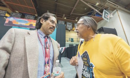
Navajo Times | Krista Allen Grand Staircase-Escalante is seen in the background as rocks surface on Lake Powell, on Friday, March 18.
DÁ’DEESTŁ’IN HÓTSAA
While water levels at drought-stricken Tooh Bikooh have dropped below elevations water managers had fought to protect, there are new attractions to see.
“All of that land that was under, when the water went in, is all now surfacing,” said Judy Franz, executive director of the Page-Lake Powell Chamber.
The channel that leads to the Glen Canyon Dam is impassable. The loop around Lone Rock isn’t possible because the monumental slab is surrounded by sand. And the shortcut from Wahweap Bay to the rest of the reservoir is no longer there.
Formerly submerged islands and peninsulas are surfacing. Encroaching shorelines and rocks lurk, but the water hasn’t drained all the fun.
“Yes, the water’s down,” Franz said. “It’s Mother Nature. It’s not because we have so many people going to the lake.
“But there are new attractions to see out there,” she said.
City of Page officials said the record-low water levels are transforming the landscape, renewing a long dispute over the land the reservoir covered.
As of Wednesday afternoon, the nation’s second-largest reservoir that provides water to approximately 40 million people throughout the west sat at an elevation of 3,524.06 feet. That’s 24.13% of full pool (3,700), and 175.94 feet below full pool, and below the Bureau of Reclamation’s target elevation of 3,525 feet of elevation.
This means that the reservoir has dipped into a zone where the generation of hydropower by water flowing through the Glen Canyon Dam is unreliable because at 3,374 feet, Lake Powell is at what experts call “dead pool.”
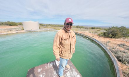
“We have a big rock out there, it’s called either Whale Rock or Blimp Rock (now),” said Franz, who owns a fishing guide service that had to adjust to the water level. “I think people are going to find new adventures when they’re out there.
“The mayor (Bill Diak) and I, and the city of Page, we have all been pushing that everyone’s still open for business,” she added. “Everybody’s still able to go to work. And it’s still a beautiful lake to come to. It’s just a little different, a little changed.”
Waiting for snow melt
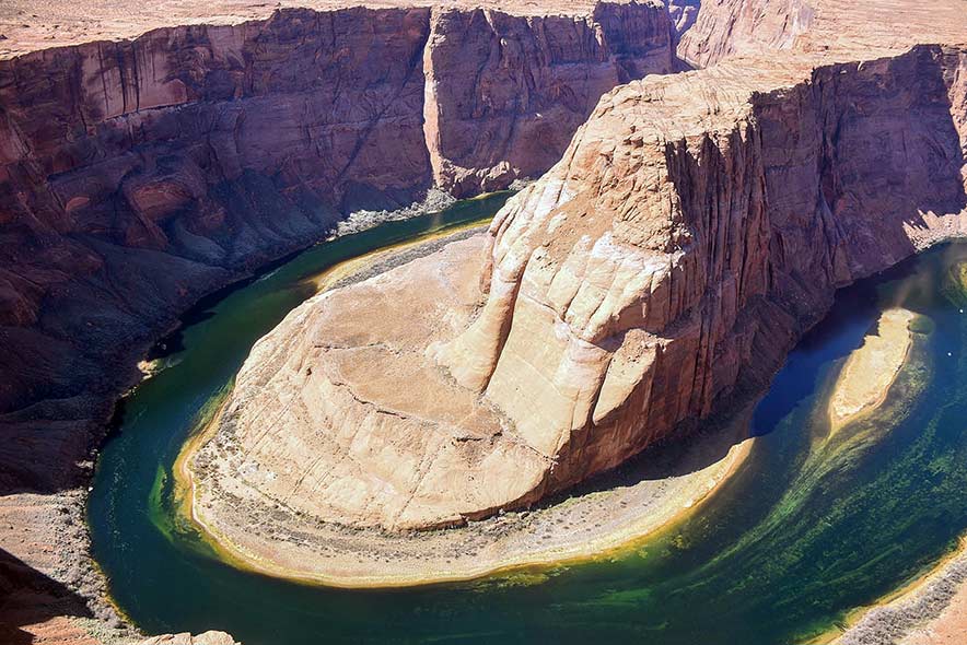
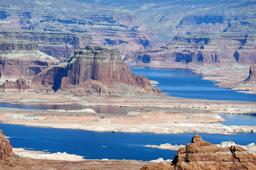
Navajo Times | Krista Allen
The Vermilion Cliffs are seen as Tooh Bikooh loops around Horseshoe Bend near Dá’deestł’in Hótsaa on Friday, March 18.
City officials said they are hopeful the spring snow melt starts in about 60 days. This means if the water goes down by an average of .10 feet a day until the spring snow melt, the water will go down by 6 feet and be at about 3,518 by then.
If the water goes down by .12 feet a day, then the water will go down by about 7.2 feet and be at 3,517 by the spring snow melt. But the snow melt start varies, according to experts, who say the snow melt started in May last year.
“We don’t know what the snowpack is going to do this year because we (won’t) see it until probably April or May,” Franz said. “It won’t come all the way back up this year of course, but I think we’ll get some runoff.”
Diak added that the water level is nearing critical state, but it should come up soon.
“So as far as that having an effect on us here, the low water level itself is having an effect on the lower lake and Wahweap Bay,” Diak said. “They’ve had to move a lot of boats around off the buoy fields because (the water) is too shallow.
“And then losing access to Antelope Point Marina, (Halls Crossing and Bull Frog, Utah). There’s no public ramp there either,” he said. “All of those areas attribute to visitation to our region. So, it’s kind of tough not to have those lake access.”
Diak said the Page-Lake Powell area gets an annual visitation of nearly 4 million people a year. Last year, visitation was down.
“In 2020, that number dropped down to below just a little below three million,” Diak added. “This last year, it did come up, but it was still approximately 20- to 30-percent prior to 2019 figures in 2021. But it came back up substantially. Now I’m thinking this year is going to be better yet.”
How does it affect Diné in the nearby Navajo Nation?
Srinivasa Venigalla, Navajo Tribal Utility Authority’s deputy general manager for electric operations, said from a utility standpoint, low water levels in the Colorado River means less hydro energy to the NTUA.
“Which means we must fill the shortfall with market purchase, which could result in higher costs to all our customers,” Venigalla told the Navajo Times on Wednesday. “We are monitoring the situation and closely following the updates from the Bureau of Reclamation.”

 Highway 264,
 I-40, WB @ Winslow