


Staking a claim
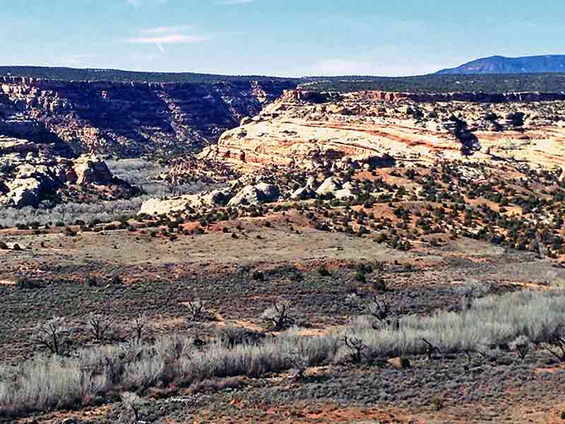
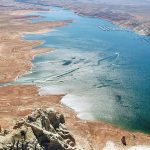
The proposed Diné Bikéyah Conservation area includes 1.9 million acres of the most ruggedly beautiful country in Utah. Within its borders would be Natural Bridges National Monument, a wilderness area, part of Glen Canyon Recreation Area, Comb Ridge, Cedar Mesa and Valley of the Gods. (Times photo — Cindy Yurth)
In San Juan County, time is running out for a Diné vision of land management
The proposed Diné Bikéyah Conservation area includes 1.9 million acres of the most ruggedly beautiful country in Utah. Within its borders would be Natural Bridges National Monument, a wilderness area, part of Glen Canyon Recreation Area, Comb Ridge, Cedar Mesa and Valley of the Gods. (Times photo — Cindy Yurth)
BLANDING, Utah
This land certainly looks like it would be big enough for everybody.
Pull off State Road 95 anywhere west of Blanding and solitude is cheap. The only sound is the descending chromatic scale of a canyon wren.
Other than the tracks in the red sand at your feet, which chronicle a recent skirmish between a kit fox and some unfortunate rodent, the view is one of unrelenting peace as far as the eye can see.
But don’t be fooled. These are some of the most hotly contested lands in the country.
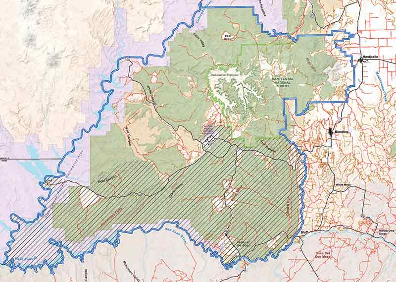
This map shows the proposed Diné Bikeyah National Conservation Area. The cross-hatched area indicates lands where the Navajo tribe would have a say in the management of the natural and cultural resources, for instance, medicinal plants. (Courtesy Utah Diné Bikéyah)
For decades, politicians have mostly stayed out of the gorgeous mess that is southern Utah. The geography — a jumble of canyons, arroyos, slickrock mounds and volcanic plugs — is complex enough, but the political landscape is un-navigable.
Tidy squares of state school trust lands are interspersed with sprawling BLM tracts, wilderness and wilderness study areas, national forest, national and state parks and Indian reservations.
Add to that the fact that this is some of the nation’s richest land in terms of gas, oil and minerals, and some of the poorest in terms of per capita income, then stir in a strong states’ rights ethic and a whole lot of guns — and did we mention that both granola-crunching backpackers and camo-clad ATV enthusiasts love to recreate here? — and you have a toxic brew that state, local and national politicians have left to simmer on its own (and sometimes boil over) for decades.
To read the full article, pick up your copy of the Navajo Times at your nearest newsstand Thursday mornings!
Are you a digital subscriber? Read the most recent three weeks of stories by logging in to your online account.

 Highway 264,
 I-40, WB @ Winslow